How to read a reservoir for bass structure
Let's be honest, staring out at a vast Nevada reservoir can feel a little overwhelming when you're trying to find bass. It's not like a small pond where every ripple tells a story. These big bodies of water, from the massive expanse of Lake Mead to the high-desert beauty of Wildhorse Reservoir, often look like endless sheets of water, leaving many anglers scratching their heads, wondering "where in the heck do I even start?" The secret, my friend, isn't luck; it's learning to "read" the reservoir, understanding the subtle clues that tell you where the bass are likely hiding. This guide is all about equipping you with that knowledge, transforming you from someone just casting blindly to an angler with a plan.
Understanding Bass Behavior and Reservoir Dynamics
Before you can truly read a reservoir for bass structure, you need to step into the mind of a bass. What drives them? What do they look for? And how do the unique characteristics of Nevada's reservoirs influence their choices? It's not just about tossing a lure; it's about understanding the underwater world from a fish's perspective.
The Core Needs of a Bass: Food, Shelter, and Spawning Grounds
Think of a bass as having three primary goals in life: eat, hide, and make more bass. Everything they do revolves around these basic needs. Structure in a reservoir provides one or more of these crucial elements.
- Food: Bass are ambush predators. They love to hide near structure that offers a vantage point to surprise unsuspecting baitfish or crawdads. This could be a submerged rock pile, a brush line, or the sharp edge of a drop-off. If a piece of structure holds bait, it almost certainly holds bass. In Nevada's typically clear desert lakes, baitfish like shad, bluegill, or even smaller striped bass will relate to cover, and where the bait goes, the predators follow. Understanding the diet of bass in specific reservoirs can give you a huge advantage. For instance, bass in Lake Mead often key in on abundant shad, so looking for structure that aggregates shad is key.
- Shelter: Bass need protection from predators (like larger striped bass or even eagles) and from harsh environmental conditions, especially the intense Nevada sun. Deep water provides refuge from heat, while submerged trees, rocks, and ledges offer physical cover. This is especially true during the brutal summer months when bass will seek out cooler, deeper water with plenty of overhead cover. A lone stump or a dense patch of weeds in otherwise featureless water can be a magnet for bass seeking a safe haven.
- Spawning Grounds: When it's time to reproduce, bass look for specific types of structure. They prefer shallow, protected areas with a firm bottom – typically sand, gravel, or small rocks. Points, coves, and flats near deeper water are prime spawning real estate. During the Nevada Bass Season and Spawn Timing , you'll find bass congregating in these areas, often near submerged brush or roots where they can build their nests. Identifying these areas is crucial for targeting them during this critical time.
Impact of Water Levels and Clarity on Structure
Nevada's reservoirs are often characterized by significant fluctuations in water levels, especially in drought-prone years, and generally very clear water. These factors dramatically impact how bass relate to structure.
- Fluctuating Water Levels: Reservoirs like Lake Mead Nevada Fishing Guide or Lake Mohave can see water levels rise and fall by many feet over the course of a year, or even within a few months. This constant change means that what was a prime bass spot last month might be dry land today, or vice versa. A rising lake can flood new vegetation, creating fresh cover that bass will quickly move into. A falling lake, on the other hand, concentrates fish and exposes new structure that was previously hidden. Anglers need to pay close attention to historical water level data and current conditions. When the water drops, previously submerged roadbeds, foundations, or even old fences become exposed, offering new insights into the underwater terrain. Understanding How water level affects fishing at Lake Mead is crucial for adapting your strategy.
- Water Clarity: Many Nevada reservoirs boast incredible water clarity. While beautiful, this also means bass are often warier and more prone to seeking deeper or denser cover. In clear water, bass tend to hang out deeper during the day, using the cover of steep drops, submerged cliffs, or heavy brush to ambush prey without being easily seen themselves. This is why techniques like dropshotting or deep jigging become so effective in these conditions. The clear water also means you might be able to visually identify structure closer to the surface on calm days, which can be an advantage. However, it also means your presentation needs to be more subtle, and your approach less intrusive.
Key Structures to Look For in Nevada Reservoirs
Now that we understand why bass use structure, let's break down the specific types of structures you'll encounter in Nevada's reservoirs and how to identify them. Each type offers a unique set of opportunities for anglers.
Natural Bottom Features: Points, Humps, Channels, and Canyons
These are the geological formations that were there long before the reservoir was filled, shaping the underwater landscape. They are universally productive.
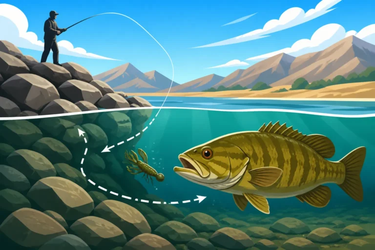
- Points: A point is a piece of land that extends out into the water, essentially an underwater finger. Bass love points because they offer a transition zone – often with shallow water on top and deeper water on the sides. They act as highways for baitfish and offer bass prime ambush locations. A point can be rocky, gravelly, or even sandy, and the best ones often have a sharp drop-off on one or both sides, creating a "breakline" where bass can position themselves. In vast lakes like Lake Mohave, identifying long, tapering points that extend far into the main lake can be incredibly productive, especially during seasonal migrations of baitfish. Look for changes in the shoreline contour above water – these often mirror points underwater.
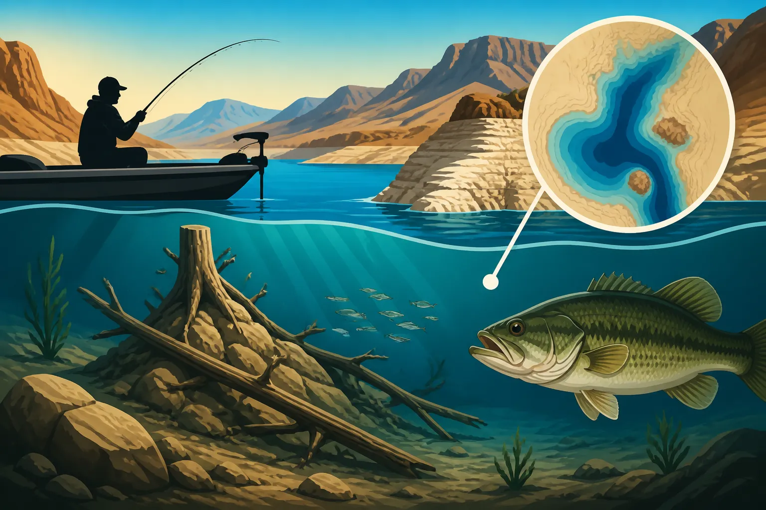
- Humps and Ridges: A hump is an elevated area on the lakebed that doesn't reach the surface, essentially an underwater island. Ridges are longer, more elongated versions of humps. These are classic deep-water bass structures, especially in summer and winter. Bass will suspend around humps or sit on top, waiting for bait to pass over. Finding humps requires good electronics and patience. Once you locate one, you can often fish all sides and the top, varying your depth to find where the bass are holding. These are fantastic structures for deep cranking, jigging, or even a Carolina rig. The deeper sections of Wildhorse Reservoir Nevada Fishing Guide are known for productive humps and ledges.
- Channels and Canyons: When a river or creek is flooded to create a reservoir, the old riverbed becomes a prominent underwater channel. These channels act as migration routes and deep-water sanctuaries for bass, especially in hot or cold weather. Bass will often suspend along the channel edges or near any structure (like stumps or rocks) that protrudes into the channel. Submerged canyons, particularly in lakes like Lake Mead, offer dramatic vertical structure with ledges and shelves that bass use for cover and ambush points. Fishing these can be challenging but incredibly rewarding. Look for the deepest parts of the lake on your map, and then identify any old river or creek routes.
Man-Made Structure and Submerged Cover
Many of Nevada's reservoirs were created by damming existing rivers, flooding valleys that often contained human settlements, roads, and forests. These submerged relics become invaluable bass habitat.
- Roadbeds and Foundations: Before a valley is flooded, there were often roads, bridges, and buildings. These structures, now underwater, become incredibly effective bass magnets. An old roadbed offers a defined travel corridor for bass, often with slightly different bottom composition than the surrounding area. Foundations of old houses or barns create complex hard cover with nooks and crannies where bass can hide. These are often most visible during low water periods, providing a rare glimpse into the history of the lake and valuable intel for when the water rises again. Check old maps or even historical aerial photos of the area before it was flooded – these can be goldmines for locating such structures.
- Standing Timber and Brush Piles: When forested areas are flooded, the trees and brush remain, creating dense underwater forests. These offer incredible vertical cover that bass absolutely adore. The branches provide shade, ambush points, and protection. Standing timber is particularly prevalent in reservoirs that weren't completely clear-cut before flooding. Brush piles, which can be natural accumulations or even intentionally placed by anglers or wildlife agencies, are also fantastic. Bass will hold tight to these, often right in the middle of the densest part. Fishing timber requires patience and often heavier gear to prevent break-offs, but the rewards can be substantial. For How to Fish for Bass in Nevada effectively in these situations, learn to pitch and flip jigs or Texas-rigged soft plastics into the thickest cover.
Tools and Techniques for Locating Bass Structure
Knowing what to look for is one thing; knowing how to find it is another. Luckily, modern technology and good old-fashioned observation provide us with a powerful arsenal.
Visual Cues and Topographic Maps
Sometimes, the best clues are right in front of you, or on a piece of paper. Don't underestimate the power of these basic tools.
- Shoreline Indicators: The shoreline above water often gives you a fantastic peek into what's happening below the surface. A rocky bluff on shore usually means rocks continue underwater. A gently sloping bank indicates a flat bottom. A sudden change from a sandy beach to a steep rock wall suggests a drop-off. Pay attention to visible changes in bottom composition, like dark patches of weeds or lighter sandy areas, especially in clear water. Also, look for distinct "cuts" or "dips" in the shoreline, which can indicate the presence of submerged creek channels or deeper water access points.
- Topographic Maps: These are your absolute best friend for pre-trip planning and on-the-water navigation. Modern fishing apps like Navionics, C-MAP, or even Basemap (available for purchase on Amazon) offer incredibly detailed contour maps of most major Nevada reservoirs. These maps show you depth changes, submerged channels, humps, points, and old roadbeds. Before you even launch your boat, you can spend hours studying the contours, identifying potential bass holding areas, and marking waypoints. Look for areas where contour lines are tightly packed (steep drops) versus spread out (flats). Identify main lake points, major creek channels, and isolated humps – these are all high-percentage areas to start your search. Many anglers find the "before and after" maps (pre-flood and post-flood) especially useful for spotting old structures.
Using Sonar and Fish Finders Effectively
Once you're on the water, your electronics become your eyes underwater. Investing in a good fish finder is arguably one of the best decisions you can make for reservoir bass fishing.
- 2D Sonar: This is your traditional fish finder view, showing you depth, bottom contour, and arches that indicate fish. It's excellent for finding major depth changes, identifying bottom hardness (hard bottoms show a thicker, brighter return), and seeing fish directly beneath your boat. You can spot the presence of submerged trees or rock piles as irregular shapes. When you're cruising, keep an eye on your 2D sonar for sudden depth changes or "blow-ups" on the screen that indicate baitfish or structure.
- Down Imaging (or DownScan): This technology provides a picture-like view of what's directly beneath your boat, with incredible detail. You can distinguish individual tree branches, see distinct rock piles, and even identify the type of submerged vegetation. It's invaluable for confirming what you suspect is down there based on your map or 2D sonar. If you're idling over a suspected brush pile, down imaging will clearly show you the actual brush, making it easier to position your boat for a precise cast.
- Side Imaging (or SideScan): This is where the game really changes for structure fishing. Side imaging lets you see out to the sides of your boat (often up to 100-200 feet on each side) with photo-like clarity. You can literally "scan" a huge area for submerged humps, roadbeds, rock piles, and brush. It's like having an underwater drone scouting for you. Instead of driving directly over a spot, you can parallel a contour line, scanning a wide swath of the lakebed. When you spot a promising piece of structure, you can then mark a waypoint and move in to fish it. This is particularly effective for finding isolated cover in otherwise featureless areas, a common scenario in many Best Places to Fish in Nevada reservoirs. You can find excellent units from brands like Humminbird, Lowrance, and Garmin on Amazon, making Best fish finder for reservoir fishing an easy upgrade to your boat.
Trial and Error: The Importance of Exploration and Observation
No matter how good your maps or electronics are, nothing beats time on the water, observing and experimenting.
- Continuous Observation: Pay attention to everything around you. Where are the birds diving? That often means baitfish are being pushed to the surface, and bass might be below them. What's the wind doing? Wind can push baitfish into certain coves or against specific points, making those areas more productive. Are other anglers catching fish, and if so, where and with what techniques? While you don't want to crowd anyone, observing patterns can provide valuable clues.
- Keeping a Fishing Log: After each trip, jot down notes: what structures you fished, what lures worked, water temperature, weather conditions, time of day, and any success or failures. Over time, this log becomes an invaluable resource, helping you identify patterns and learn Seasonal Movement of Fish in Reservoirs in your favorite spots. You'll start to see that a certain point produces best in spring, or a specific submerged roadbed is hot in late fall.
- Adaptability: Reservoirs are dynamic environments. Water levels change, weather patterns shift, and fish move. Don't get stuck on one spot or one technique if it's not producing. Be willing to explore new areas and try different approaches based on what the lake is telling you. Maybe the bass aren't on the main lake points today, but they've moved into Shallow Water Techniques for Cove Bass Fishing due to a sudden drop in temperature. Learning to adapt your strategy is a hallmark of a successful reservoir angler.
Putting It All Together: Developing Your Reservoir Strategy
Reading a reservoir for bass structure isn't just about identifying individual features; it's about integrating all this information into a cohesive fishing strategy. It's a continuous learning process that evolves with each trip.
Seasonal Adjustments for Structure Fishing
Bass use structure differently throughout the year, driven by water temperature and their biological urges. Understanding these seasonal shifts is paramount.
- Spring (Pre-spawn & Spawn): As water temperatures rise, bass move from their deeper wintering grounds towards shallow, protected spawning areas. They'll stage on points and submerged humps adjacent to these spawning flats. Look for rocky or gravelly bottoms in coves and pockets. During the actual spawn, they'll be directly on beds, often near brush or roots in 2-8 feet of water. This is when a good pair of polarized sunglasses (you can find plenty of options on Amazon) can help you spot beds.
- Summer: With high summer temperatures, bass will retreat to deeper water to find cooler, more oxygenated conditions. They'll often relate to deep points, humps, channel bends, and the submerged canyons or cliffs found in lakes like Lake Mead or Lake Mohave. Vertical structure, like standing timber in deep water, becomes incredibly important. This is prime time for Deep Water Techniques for Lake Mead Bass using jigs, deep-diving crankbaits, or dropshots. Pay attention to Best water temperature for bass fishing – bass will gravitate to their preferred thermal zones.
- Fall: As water temperatures cool, bass become more active and move shallower, often following baitfish that are also moving towards the surface and shallower coves. They'll utilize a wider range of structure, from main lake points to creek channel swings, brush piles, and even rocky banks. This is often considered one of the best times to fish, as bass are aggressively feeding in preparation for winter.
- Winter: In the coldest months, bass generally move deep again, often concentrating in large schools on deep humps, main lake points, or within submerged channels. They become less active, but a slow presentation with jigs, spoons, or dropshot rigs can be very effective. Finding these deep schools on your fish finder is key.
The Patience and Persistence Required
Let's be realistic – reservoir fishing in Nevada isn't always easy. These are big, challenging bodies of water, and finding bass consistently requires a significant investment of time and effort. There will be days when you hit all the "right" spots according to your map and electronics, and the bass just aren't there. That's part of the game.
The key is persistence. Every trip, even a slow one, is a learning opportunity. Did the water level drop? Did the wind shift unexpectedly? Was the water clarity different? All these observations feed into your understanding of the reservoir. Don't be afraid to experiment with different lures – check out Best Lures for Nevada Bass for some ideas – or try new structures. The more time you spend deciphering the underwater world of these magnificent Nevada lakes, the more rewarding your fishing experiences will become. Eventually, you'll start seeing patterns, making educated guesses, and truly understanding How to find fish in a new lake more efficiently.
Disclaimer
Fishing conditions and regulations in Nevada can change. Always check the latest Nevada Department of Wildlife (NDOW) regulations before heading out. Be aware of local conditions, especially regarding water levels and weather, and prioritize safety on the water. This guide is for informational purposes only and does not guarantee fishing success.